Is "blocking" causing the incoming heatwave in Australia?
Australia is set to scorch this week, with the majority of southern Australia under heatwave conditions. The mercury is expected to exceed 40C in many locations across South Australia, Victoria, the ACT and New South Wales including the capital cities of Adelaide, Melbourne, Sydney and possibly Canberra. Warnings have been issued and fire bans are being put in place as emergency services, various institutions and members of the public prepare for the heat.
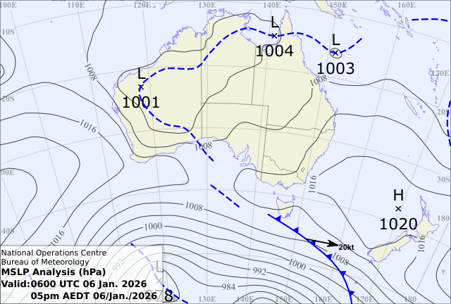
Understandably there is, and will be, a lot of commentary about this heatwave and the mechanisms behind it. For example, the ABC reports that the heatwave is a result of a “strong high-pressure system … causing a jam in the flow of weather … preventing the heat from moving swiftly from west to east, … leading to days upon days of warmth”. No doubt, climate modes of variability such as the El Niño Southern Oscillation (ENSO) and local SST anomalies around the continent will also be invoked by some in the coming days - although many of them do not line up in this case. Neither what you may see on a surface synoptic chart, nor the usual climate variability talking points are the cause of this event. The answer - as it always does in extreme heat in the southeast - lies about kilometres above the earth’s surface.
Heatwaves over the southeast of Australia are well studied and the current example is in many respects a classic case. Heatwaves, and hot days for that matter, in this part of the world are induced by high pressure systems in the upper troposphere1. Upper-level high pressure systems result in forcing air surfaceward. As these parcels of air descend, the increasing pressure forces the air to compress, heating it up. This hot air is what we eventually experience on hot days in the subtropics. Generally, the slower this system moves the longer we swelter, turning a hot day into an extended period of heat.
Of course, there are other factors that heat the air around us on very hot days. This includes, warm air advection (air being transported from hotter places), land surface feedbacks, diabatic heating (air being heated by the formation of clouds), and several others. Despite this, it is now relatively well understood that the primary driver of this increase in temperature is the warming of air as it descends from the upper troposphere.
Many scientists and commentators often talk about “blocking” when discussing heatwaves. Blocking, which is by definition a very slow and persistent upper tropospheric anticyclone, is of course a big part of the heatwave puzzle as previously discussed. However, blocking is often misdiagnosed, as is the case in this event. In this case, the aforementioned ABC article sites a persistent high pressure on the surface mean-sea level pressure map, calling it a “blocking high”. This is in my view, is a misdiagnosis. First, blocking is analysed in the mid- to upper-troposphere not on the surface and secondly it is not the surface high pressure system that is important for heatwaves.
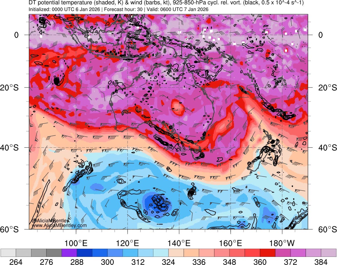
The question then naturally becomes: Am I just flapping for no apparent reason? Is the persistent surface high simply symptom of blocking in the upper troposphere? The answer: Not really… By animating the current forecast charts (as shown below), it can be readily seen that this upper-level high moves relatively quickly through the southeastern parts of Australia without causing a “traffic jam” of the atmospheric flow (an analogy often used when talking about blocking)2. The troughs (the blue bits extruding to the north) and the ridges (the pink bits extruding southwards) are generally moving at a similar pace from west to east.
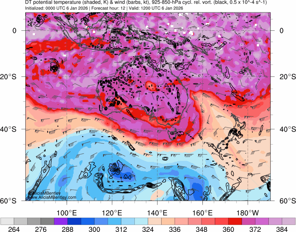
In this heatwave, “blocking” is not the cause. Instead, there are two separate upper-tropospheric anticyclones (ridges) that appear, driving descent and heat into the southeast. This repeated ridging can readily be seen in the maximum temperature forecast for Melbourne issued by the Bureau of Meteorology (valid Tuesday 06/01/26). The first upper ridge coincides with a maximum temperature forecast of 42C for Wednesday (07/01/26) sees an expected maximum of 42C, while the second coincides with a maximum temperature forecast of 40C for Friday (09/01/26). However between these two events as the second ridge begins to form, is some relief (at least for areas adjacent to the coastline) with a maximum temperature forecast for Melbourne of only 29C on Thursday (098/01/26).
Maybe these details are unimportant to most Australians as they turn up the aircon and stock up on Icy Pole’s to get them through the heat. But as scientists - particularly those that commentate on our weather and climate to a general audience - accuracy in the commentary must be important, particularly in a world weather and climate mis- and disinformation. We need to do better.
Parker, T. J., Berry, G. J. & Reeder, M. J. The structure and evolution of heat waves in Southeastern Australia. Journal of Climate 27, 5768–5785 (2014).
Nakamura, N. & Huang, C. S. Y. Atmospheric blocking as a traffic jam in the jet stream. Science 361, 42–47 (2018).